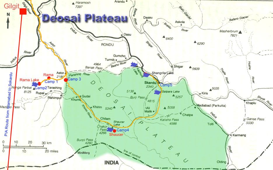
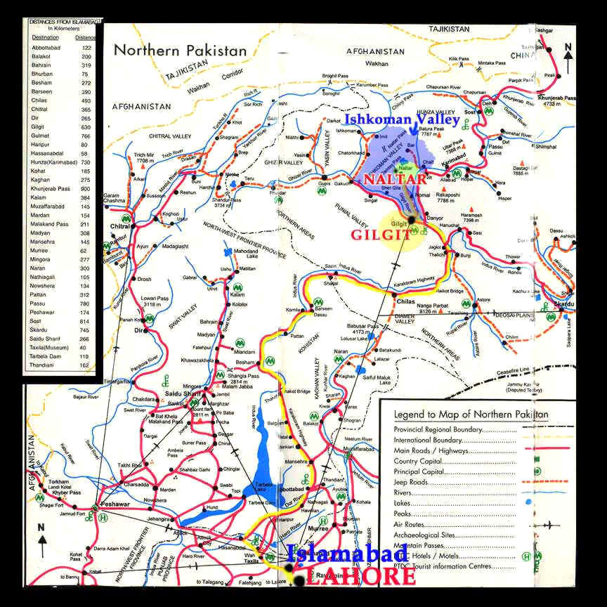
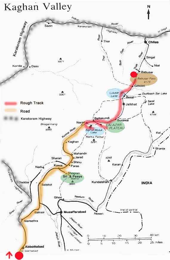
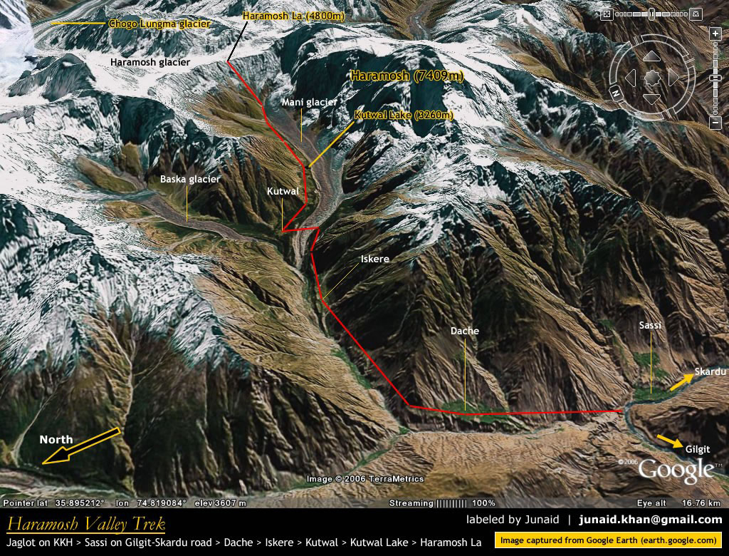
The best Maps (detailed) regarding Northern Areas of Pakistan for all
sorts of expeditions are available at the major book shops in Pakistan
with the name of Atlas
Of Northern Areas Of Pakistan
.It is a set of 3-4 different maps which covers complete details of
tracks, climbing routs, base camps, culture, villages, glaciers,
bridges, reset houses, TDCP hotels, ethnic groups, tribes,
languages, rainfall, history, small & big towns, facilities, peaks, wild
life geology, temperatures, distance, lakes, boundaries,tranport etc.
These maps covers all the required aspects of Northern areas. In our view
these are the best maps ever produced for these areas.
In Lahore they are
available at: Ferozesons (book Store), Mall road Lahore Pakistan
Atlas Of Northern Areas Of Pakistan
MAP-1
Gilgit, Ghizer,
Diamar, Skardu , Ghangche
Scae 1 : 500,000
Atlas Of Northern Areas Of Pakistan
MAP-2
Chitral, Dir,
Swat, Kohistan, Murree, Bunair, Malakand, Swabi, Batgram, Shangla,
Abbottabad, Manshera, Haripur, Mardan
Scale 1 : 500,000
Atlas Of Northern Areas Of Pakistan
MAP-3
Gilgit, Ghizer,
Diamar, Skardu , Ghangche
Scale: 1 : 1,000,000


